


Moniteau Voting District, Howard County, Missouri
About
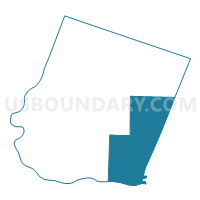
Outline

Summary
| Unique Area Identifier | 608040 |
| Name | Moniteau Voting District |
| County | Howard County |
| State | Missouri |
| Area (square miles) | 80.01 |
| Land Area (square miles) | 78.95 |
| Water Area (square miles) | 1.06 |
| % of Land Area | 98.68 |
| % of Water Area | 1.32 |
| Latitude of the Internal Point | 39.06841300 |
| Longtitude of the Internal Point | -92.57996900 |
Maps


Graphs
Select a template below for downloading or customizing gragh for Moniteau Voting District, Howard County, Missouri


Neighbors
Neighoring Voting District (by Name) Neighboring Voting District on the Map
- Voting District 07, Boone County, MO
- Voting District 18, Boone County, MO
- Voting District 19, Boone County, MO
- Bonne Femme Voting District, Howard County, MO
- Boonville Rural No. 1 Voting District, Cooper County, MO
- Franklin Voting District, Howard County, MO
- Richmond Voting District, Howard County, MO
Top 10 Neighboring County Subdivision (by Population) Neighboring County Subdivision on the Map
- Boonville township, Cooper County, MO (10,371)
- Perche township, Boone County, MO (4,079)
- Katy township, Boone County, MO (3,787)
- Richmond township, Howard County, MO (3,676)
- Bourbon township, Boone County, MO (2,729)
- Franklin township, Howard County, MO (1,798)
- Moniteau township, Howard County, MO (1,026)
- Saline township, Cooper County, MO (840)
- Bonne Femme township, Howard County, MO (625)
Top 10 Neighboring Place (by Population) Neighboring Place on the Map
Top 10 Neighboring Unified School District (by Population) Neighboring Unified School District on the Map
- Columbia Public Schools, MO (136,836)
- Boonville School District, MO (11,591)
- Fayette R-III School District, MO (5,145)
- Harrisburg R-VIII School District, MO (3,294)
- New Franklin R-I School District, MO (2,646)
Top 10 Neighboring State Legislative District Lower Chamber (by Population) Neighboring State Legislative District Lower Chamber on the Map
- State House District 24, MO (46,896)
- State House District 9, MO (36,616)
- State House District 117, MO (35,534)
Top 10 Neighboring State Legislative District Upper Chamber (by Population) Neighboring State Legislative District Upper Chamber on the Map
Top 10 Neighboring 111th Congressional District (by Population) Neighboring 111th Congressional District on the Map
Top 10 Neighboring Census Tract (by Population) Neighboring Census Tract on the Map
- Census Tract 19.01, Boone County, MO (4,270)
- Census Tract 18.03, Boone County, MO (4,222)
- Census Tract 9603, Howard County, MO (3,718)
- Census Tract 9602, Howard County, MO (3,476)
- Census Tract 9501, Cooper County, MO (3,303)
- Census Tract 9502, Cooper County, MO (3,170)
- Census Tract 9601, Howard County, MO (2,950)